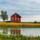
The SPAW (Soil-Plant-Air-Water) model simulates the daily hydrologic water budgets of agricultural landscapes with two connected modules, one for farm fields and one for impoundments such as wetland ponds, lagoons or reservoirs. The model was developed to understand and predict agricultural hydrology and its…
Benefits Toolkit
This online tool compares predevelopment, conventional development, and development with Green Stormwater BMPs for a single site. Results include changes in total runoff volume, pervious area, and life cycle costs. Inputs include: site size, predevelopment land cover, post development land cover, and parameters for…
eBird is a database of citizen science bird observations that allows for tracking of bird species distribution and abundance worldwide. The online database is freely accessible and made possible by millions of bird observers across the world uploading information from field observations. The only required input is…
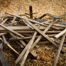
This Microsoft Excel-based calculator estimates the cost and environmental benefits of four scenarios for handling hardscape and landscape wastes (concrete and asphalt, brick, lumber, and yard waste): (1) Reusing all waste possible on-site, recycling all waste possible that cannot be reused, and disposing of waste…
This tool estimates the net embodied carbon of a project’s structures and site. The measurements account for building materials, processes and carbon released due to ecosystem degradation or sequestered through landscape installation or restoration. Landscape inputs are ecoregion, area and type of existing vegetation…
This Microsoft Excel-based calculator compares the cost of converting conventional landscapes to landscapes that require less irrigation and produce less waste. Inputs include: configuration of the current landscape (proportion that is comprised of flowers, turf, shrubs, and ground cover), configuration of landscape…
This Microsoft Excel-based calculator compares the costs of building a new deck with recycled plastic, recycled wood/plastic composite lumber, cedar/redwood, and pressure-treated yellow pine. Based on the size of the project, the calculator estimates the initial, 3-year, 6-year, 10-year, lifetime, and average annual…
SOPARC is a direct observation tool for assessing use of parks and play areas. The tool provides protocols for observers to track users’ physical activity levels, activity types, genders, and estimated age and race/ethnicity groupings during a specified time frame using momentary time sampling. It can also be used to…
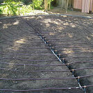
This Microsoft Excel-based calculator compares the water use and cost of a sub-surface drip irrigation system (with rain-shutoff device) to conventional sprinkler irrigation. The only inputs are: irrigated area, water rate cost, length of growing season, number of days per month with over 1/2” of rain, and frequency of…
This Microsoft Excel-based calculator is designed to help landscape and construction companies estimate the cost of using environmentally beneficial compost filter berms or compost filter socks for erosion control, rather than conventional silt fences. Inputs are: linear feet of erosion control needed, estimated…

